RSS

Category Archives: Silverthorne Area

Silverthorne Town!

Town of Silverthorne Engages Marketing Partners to Share Its Story and Vision

Betty Ashley Public Relations and Spin hired to

refresh Silverthorne brand and deploy marketing campaign


Silverthorne, Colorado – November 11, 2015 – To many travelers, Silverthorne is known as the first exit west of the Eisenhower Tunnel with easy access to gas stations, fast food, and of course, outlet stores. For neighbors along the I-70 corridor, it’s also a retail mecca with a Target, Lowe’s and Murdoch’s to name a few. But locals know there’s much more to their community and the Town of Silverthorne hopes to share its story and vision, putting itself on the map as a vibrant town for families and businesses to prosper.


“We have a comprehensive plan for the Town’s development including a vision for the town core, a new arts and culture plan, a new performing arts center currently under construction, and a very active economic development advisory council. Most importantly, we have a Town Council that is fully committed to delivering on the community’s goals,” said Ryan Hyland, Silverthorne Town Manager. “With so much potential, we have engaged creative partners to help us refresh our brand image and tell our story.”


After undergoing a rigorous review of PR and marketing agencies, the Town of Silverthorne has engaged Betty Ashley Public Relations and Spin.


“We are ecstatic about the opportunity to help Silverthorne share its vision for enriching the quality of life and economic sustainability of the community,” said Ashley Lowe, founder of Betty Ashley PR. “Our first step is to conduct research, including working closely with key stakeholders throughout the town, and then develop recommendations to enhance the Town’s brand image. It’s incredibly important and rewarding work that will have an impact for years to come.”


In 2016 Silverthorne will welcome the Lake Dillon Theatre Company, which is relocating from Dillon to a temporary space next to the Colorado Welcome Center in the Outlets at Silverthorne before moving to its permanent new home in Silverthorne’s downtown at 4th Street next to the Silverthorne Pavilion.


The Town of Silverthorne has worked diligently for a number of years to establish the   vision for development of a vibrant and pedestrian-friendly downtown, and articulated that vision in its 2014 Comprehensive Plan.  The Town is also close to finalizing its Arts and Culture Strategic Plan, for which the new theatre provides a launching point.


New businesses locating in Silverthorne indicate that the Town is on the right track.   Locally owned and operated Baker’s Brewery and Higgles Ice Crème both opened in 2015, as did Summit County’s first Starbucks drive-thru. Hampton Inn and Suites will be opening before the holidays, bringing one of the first new hotels in many years to Summit County. Dunkin Donuts will also open its first Colorado mountain location in Silverthorne before the holidays. 2016 brings more culinary excitement directly to Silverthorne’s downtown area with Angry James Brewery and Sause on the Blue scheduled to open, and the popular Sunshine Café will be expanding.


Betty Ashley PR and Spin previously partnered on PR and marketing for Silverthorne’s newest single-family development, Summit Sky Ranch, with 240 residences to begin construction in 2016.


About Silverthorne

The Town of Silverthorne is a municipal government, incorporated in 1967 and operating under a Home Rule Charter adopted in 1994, which provides municipal services to Silverthorne residents and guests.  Silverthorne’s Mission Statement is: To provide a year-round, family community with economic, recreational and social opportunities for all citizens to have a mountain quality of life.  An incredible network of parks, trails and open space, along with a 60,000 sq. ft. recreation center, help the Town to deliver on that mission.  To learn more about the Town of Silverthorne, please visit www.silverthorne.org.


About Betty Ashley Public Relations

Louisville, Colorado-based Betty Ashley PR specializes in brand positioning, media relations, stakeholder analysis, message development, strategic planning, crisis planning & management, community relations, content creation, social media and events. As a boutique, independent PR agency, Betty Ashley partners with other talented communications and creative professionals based on the scope of work and expertise required. To learn more, visit www.bettyashley.com.


About Spin

Spin was founded 20 years ago in Breckenridge. Currently located in Denver, Spin specializes in brand assessment and development, marketing strategy, design and production, as well as digital creative and development. The Spin team approaches every creative endeavor with unique specificity, tailored to the traits, personality and intentions of each of its clients.  To learn more, visitwww.spindenver.com.PreviewImageDesk

 

Posted by on December 3, 2015 in Activities for the Family, Silverthorne Area, Summer Activities!

Comments Off on Silverthorne Town!

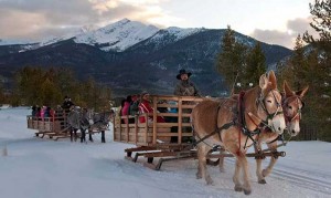
Dinner Sleigh Rides in the High country


Exclusive discounts for Summit Peaks Guests!

wintersleigh1

http://dinnersleighrides.com/

group-events1


Posted by on October 22, 2014 in Activities for the Family, Frisco Area, Silverthorne Area, Special Deals, Summer Activities!, Weddings

Comments Off on Dinner Sleigh Rides in the High country

Best Snowmobile Tours ever! Get 10% off as our Guest!

    1. Colorado Snowmobile Tours


      Experience Colorado’s Finest Snowmobile Adventure!

      Colorado snowmobile tours are an adventure through the Colorado High Country. Our experienced guides will take you through lush forests to some of the most awesome views of the majestic Colorado Rockies. Let our professional staff help you experience Colorado. It’s the place we live, love and are proud to call home.

      Snowmobiling in Colorado

      Come experience Colorado’s beauty with a snowmobile vacation in Summit County Colorado area, including Breckenridge, Dillon, Frisco, Copper Mountain, Keystone, Silverthorne, and even the Vail area. High Country Tours is approximately 1 1/2 hours away from Denver. It’s the memory of a lifetime.

      Colorado snowmobile tours & snowmobile rentals

      We create the perfect experience of snowmobiling in Colorado by offeringguided snowmobile tours as well as unguided snowmobile rentals in the Summit County area. We are conveniently located to four of Colorado’s best ski areas – Breckenridge, Copper Mountain, Keystone and Arapahoe Basin.

      Our guided snowmobile tours offer a wide range of adventures, from beginner and family tours to advanced, as well as specialized group tours and everything in between. High Country Tours has something for everyone.

      High Country snowmobile tour company is dedicated to customer service and will create a customized Colorado snowmobile trip for you and your family, company, or group of friends.

      Snowmobile trips that are fun & safe

      Dedicated to providing our guests with the best possible snowmobile tour in Colorado, we deliver snowmobile adventures that are fun, safe, memorable, and exciting. High Country Tours snowmobile company will handle all the details including terrific meals, personalized service and the most technically advanced equipment and guides. So come and join us for the snowmobile vacation of a lifetime!

      Information on snowmobile rentals.

      Map of High Country Snowmobile Tours, Inc.
  1. High Country Snowmobile Tours, Inc.
    Write a review
  2. Address: 130 Main St #6, Dillon, CO 80435
    Hours:
    Open today · 8:00 am – 8:00 pm
  3. Reviews
    “I really cannot say enough about my experience with High Country Tours!”
    “Just went on the snowmobile adventure with our family.”

    View all Google reviews


Posted by on September 20, 2014 in Activities for the Family, Breckenridge Area, Silverthorne Area, Snowmobile Tours, Special Deals

Comments Off on Best Snowmobile Tours ever! Get 10% off as our Guest!

Hut trips in Colorado!!


Get to know Colorado by visiting the 10th mountain Division Huts! 


Trailhead Directions and Details

Take special care with trailhead location. Allow extra time the morning of your trip in case the trailhead is not plowed or otherwise difficult to find or use. Check “New & News” on this website for critical trailhead changes. As parking at trailheads is often limited, please carpool or use a shuttle service whenever possible. Click here for GPS information.

ATTENTION HUT USERS: Due to break-in’s at a few of our trailheads we stongly urge all hut users not to leave anything of value in your car. If you must leave something in your car make sure it is either locked in your trunk or well out of sight.


Aspen Area Trailheads

Hunter Creek Trailhead
ELEVATION: 8,380 feet
10TH MTN MAP: Smuggler Mtn
USGS MAP: Aspen

To reach the Hunter Creek Trailhead, start in the town of Aspen. Follow Main Street in Aspen to Mill Street (the stoplight near the center of town, next to the Hotel Jerome). Turn N on Mill and drive a short distance down a hill, then across a bridge over the Roaring Fork River (.25 miles). Bear left after the bridge and follow the Red Mountain Road 1 mile to its second switchback. Just before the switchback, turn right and downhill on the Hunter Creek Road. Drive approximately .3 miles on Hunter Creek Road, then take a hard left on an unpaved driveway that leads up past a water tank 300 feet to a parking area. The actual trailhead is farther up the mountain, but this is the only parking.

You have several choices for foot travel to the actual trailhead. The simplest method is to walk back down the driveway to the Hunter Creek Road, turn left through two stone gate posts marked “Private,” and follow the paved Hunter Creek Road 1/3 mile around a hairpin switchback to the well-signed Hunter Creek Trailhead on the right side of the road. Your other choice for foot travel is to follow a foot trail that traverses up the mountain from the parking area to the trailhead.

Print These Directions

New Upper Hunter Creek Trailhead
ELEVATION: 8,400 feet
10TH MTN MAP: Smuggler Mtn
USGS MAP: Aspen

For the New Upper Hunter Creek Parking Area follow Hunter Creek Road up Red Mountain (See Hunter Creek TH directions) and go NE through the stone pillars continuing up Red Mountain Road for approximately 6/10th of a mile to a 3-way intersection. Take a very hard tight turn, and continue E 1/4th of a mile through two sharp swithbacks. You are now on private property. Please respect the homeowners and use the linked map to find the parking area. Do not enter private, marked driveways and do not cross the bridge. Upper Hunter Creek Trailhead Map


Print These Directions

PLEASE NOTE THESE IMPORTANT RULES FOR THE NEW PARKING AREA:

This is intended primarily as a skier drop-off area. Be prepared to drop your gear here and return your car to the Hunter Creek Parking area. There are a total of four (4) parking spaces in the skier drop-off area. Two are designated parking spots for 10th Mountain Division Hut users. One is for senior citizens and the last is for handicap parking. The parking spots are on a first-come first-served basis. If you are using it for overnight parking you must leave a copy of your confirmation sheet on the dashboard of your car showing the designated night(s) you will be at the hut. Your car may be ticketed or towed if you a) do not leave proof of hut use or b) are illegitimately parked in the senior or handicapped parking spot. Four-wheel drive is recommended.

Lenado Trailhead
ELEVATION: 8,640 feet
10TH MTN MAP: Smuggler Mtn.
USGS MAP: Aspen

From Glenwood Springs/I-70, travel east on Hwy 82 approximately 32 miles to Smith Way. (From Aspen, this intersection is approximately 8 miles west of Aspen). Note that this intersection is located .8 mile west of the turn-off to Snowmass Village/Snowmass Ski Area. Travel downhill on Smith Way for .5 mile, cross the Roaring Fork River, and continue to a 3-way intersection. Turn left (north) at Upper River Road, (CR 17) and travel North for 1.5 miles to the sharp right turn (east) onto the Woody Creek Road CR 18. Proceed approximately 8.4 miles through Lenado to the marked 10th Mountain winter hut parking area on your right. A sign, and a chain with a lock, marks the parking area. The combination for the lock on the chain is the same as the hut combination.

Print These Directions


Fryingpan River Drainage Trailheads

Spring Creek Trailhead
ELEVATION: 8,440 feet
10TH MTN MAPS: Mount Yeckel, Burnt Mountain
USGS MAP: Meredith

From the 4-way stop sign in Basalt at Two Rivers Road and the Fryingpan River Road, follow the Fryingpan River Road approximately 25 miles to the Eagle-Thomasville Road #400. Parking is available just east of the turn off to Road #400. Do not attempt to drive this road when it is wet, even with 4-wheel drive. This road is impassible when wet!

Print These Directions

Montgomery Flats
ELEVATION: 8,250 feet
10TH MTN MAPS: Mount Yeckel, Burnt Mountain
USGS MAP: Meredith

From the 4-way stop sign in Basalt at Two Rivers Road and the Fryingpan River Road, follow the Fryingpan River Road approximately 26 miles to a marked driveway on the North side of the road (the street number is 26501). Please park in the plowed designated area for hut users and do not block the driveway. From the parking area, follow the driveway northeast for 0.1 miles, then pick up the marked trail on the right. Please follow this marked trail and respect private property.

Print These Directions

Diamond J Trailhead
ELEVATION: 8,250 feet
10TH MTN MAPS: Mount Yeckel, Burnt Mountain
USGS MAP: Meredith

Parking for the Harry Gates Hut was changed in 2002. The new parking is 0.3 miles west (down valley) from the Diamond J Ranch. Please see Montgomery Flats Trailhead for more information.

Burnt Mountain Road Trailhead
ELEVATION: 8,830 feet
10TH MTN MAP: Mount Yeckel, Burnt Mountain
USGS MAP: Nast, Meredith

From the 4-way stop sign in Basalt at Two Rivers Road and the Fryingpan River Road, follow the Fryingpan River Road approximately 26.5 miles to a Y fork in the road known as the Biglow (on USFS map). A sign indicates Elk Wallow Campground. Take the left fork (North Fork Road #501) and drive 2.6 miles to where the well-signed Burnt Mountain Road (#506) turns off to the left (north).

Print These Directions

Norrie Trailhead
ELEVATION: 8,440 feet
10TH MTN MAP: Mount Yeckel
USGS MAP: Meredith

From the 4-way stop sign in Basalt at Two Rivers Road and the Fryingpan River Road, follow the Fryingpan River Road approximately 27.5 miles to the sign that says Norrie Colony. Turn right (west), travel across the bridge, and then up a short hill. At the top of the short hill there should be a plowed area. Park in the plowed area – DO NOT block the private driveway. The road to Twin Meadows leaves this area southwest of the short hill.

Print These Directions

Granite Lakes Trailhead
ELEVATION: 8,760 feet
10TH MTN MAP: Mount Yeckel, Upper Fryingpan
USGS MAP: Nast


From the 4-way stop sign in Basalt at Two Rivers Road and the Fryingpan River Road, follow the Fryingpan River Road approximately 31.5 miles to signs for Fryingpan River Ranch and for Nast Lake/Granite Lakes Trailhead. After the turnoff, a winding dirt road leads 1.1 miles to the obvious buildings of the ranch. This road has several steep switchbacks, so 4-wheel drive is recommended during snow season.

The Granite Lakes Trailhead is just after the bridge. For the trail to Twin Meadows and Margy’s Hut, follow the marked trail around Nast Lake and begin climbing S.W.

Print These Directions

Road 505 Trailhead
ELEVATION: 9,120 feet winter; 10,040 feet summer
10TH MTN MAP: Upper Fryingpan
USGS MAP: Nast, Mt. Champion

Road 505 is a dirt spur off the paved Fryingpan Road. It was built for maintenance on the Fryingpan/Arkansas water diversion project. In winter it remains snow-covered and is shared by skiers and snowmobilers.

From the 4-way stop sign in Basalt at Two Rivers Road and the Fryingpan River Road, follow the Fryingpan River Road approximately 32 miles to an obvious parking area on the right. A sign at the parking area says Fryingpan Lakes.

Print These Directions

Hagerman Pass Road Trailhead
ELEVATION: 9,200 feet
10TH MOUNTAIN MAP: Upper Fryingpan
USGS MAP:Nast

The Hagerman Pass Road Trailhead is at the start of the Hagerman Pass Road, which connects Leadville and the Fryingpan valley. From the 4-way stop sign in Basalt at Two Rivers Road and the Fryingpan River Road, follow the Fryingpan River Road 32.1 miles to the end of the pavement, then follow Hagerman Pass Road around the sweeping bend to the left.

Print These Directions


Trailheads reached from Interstate Highway 70

West Lake Creek Trailhead
ELEVATION: 10,300 feet
10TH MTN MAPS: Summer Eagle
USGS MAP: Fulford

From the I-70 Edwards exit (#163), travel south 1/2 mile to Highway 6. Drive W on Highway 6 .7 miles to Lake Creek Road. Turn S (left) and drive 1.7 miles to West Lake Creek Road junction. Turn right and continue 1.5 miles to the end of the pavement and another 1.1 miles to the parking area at switchback. (8220′). Please Note: This trail passes through wilderness areas where we are unable to mark the trail with blue diamonds. This, along with the fact that this route is seldom traveled, can make for very difficult route finding and is not a trail we recommend for inexperienced or first time hut-users.

Print These Directions

Sylvan Lake Trailhead
ELEVATION: 8,558 feet
10TH MTN MAP: Burnt Mountain
USGS MAP: Crooked Creek Pass

From the Eagle exit (#147) on I-70 drive south .2 miles to the roundabout. Drive 1.0 mile west on Hwy 6 until the roundabout and exit on Sylvan Lake Road. Travel 1.6 miles and take a right on Brush Creek Road (aka Eagle County Road #307). Travel 8.7 miles to a “Y” intersection. Take the right fork (West Brush Creek Road) and drive 4.6 miles to Sylvan Lake. Sylvan Lake is a small state park where you’ll find good car camping, small cabins for rent, and bathrooms.

Print These Directions

Yeoman Park Trailhead
ELEVATION: 9,060 feet
10TH MTN MAP: New York Mountain
USGS MAP: Fulford

From the Eagle exit (#147) on I-70 drive south .2 miles to the roundabout. Drive 1.0 mile west on Hwy 6 until the roundabout and exit on Sylvan Lake Road. Travel 1.6 miles and take a right on Brush Creek Road (aka Eagle County Road #307). Travel 8.7 miles to a “Y” intersection. Take the left fork (East Brush Creek Road) and drive approximately 6 miles to Yeoman Park. Turn right off of the main road and travel a few hundred feet along a short spur road (over a bridge) to the obvious parking area.

Print These Directions

Vail Trailhead for Commando Run
ELEVATION: 8,220 feet
USGS MAP: Vail East

The Vail Trailhead for the Commando Run is not signed, but it’s fairly easy to find. Follow I-70 to the main Vail Exit (Exit 176) at Vail Resort. Take the exit, then travel south to a traffic circle. Turn east out of the traffic circle onto the frontage road and drive .4 miles E to an intersection marked with an oversized stop sign. Turn right (S) here and follow Vail Valley Drive .4 miles to parking at the Golden Peak Children’s Skiing Center at the base of lifts 6 and 12. In the winter parking is highly regulated, so check the parking rules when you get there.

At any rate, you can skin up the ski area from here to start the Commando Run in Mill Creek. This is a grueling start for such a nice tour, so consider accessing the Commando Run from the Vail ski lifts. There has been talk for years of a one-ride ticket for just that purpose, so check for this option. To reach the Commando Run from the lifts you can get into Mill Creek from the top of lift 6; or take a more roundabout route, finally using the Orient Express Lift to reach the west ridge of Siberia Peak. In the summer you can ride the Vail Gondola most of the way up the mountain, then hike the ridge to Siberia Peak. Cyclists can take their bike up the Gondola and ride across the ski area to the Mill Creek Road.

Print These Directions

Vail Pass Trailhead
ELEVATION: 10,580 feet
10TH MTN MAP: Resolution Mountain
USGS MAP: Vail Pass

To reach the Vail Pass Trailhead, drive I-70 14.3 miles east from Vail or 5.4 miles west from Copper Mountain Resort. Take Exit 190 and park at the indicated overnight parking area. The Shrine Pass Road leaves from the parking area. It has good signage and is well used. Please note: For winter trips, hut-users must use the non-motorized winter-use trail to access the huts. Use of the motorized winter-use trail (Shrine Pass Road) may result in a $100 fine.

Print These Directions

Boreas Pass Trailhead
ELEVATION: 10,350 feet
10TH MTN MAP: Boreas Pass
USGS MAPS: Breckenridge, Boreas Pass

From the intersection of Highway 9 (Main St) and Boreas Pass Road (County Rd. 10) in Breckenridge travel east for 3.7 miles to the winter trailhead parking area.

Section House Reservation Info

Ken’s Cabin Reservation Info

Print These Directions

Copper Mountain Trailhead
ELEVATION: 9,820 feet
10TH MTN MAP: Resolution Mountain
USGS MAPS: Copper Mountain, Vail Pass

Parking: Summit Huts Association appreciates the generosity of Copper Mountain Resort in allowing hut guests to park at Copper Mountain. Park in the Alpine Lot (formerly known as East Lot), just off Highway 91. Directions: turn into the main Copper Mountain Resort entrance and make your first left into the north end of the Alpine Lot. Park in the area near the Transportation Center, which is designated for Janet’s Cabin. Post your parking permit on the dash and make extra copies if your group requires more than one vehicle. Take the free shuttle from the Transportation Center to Union Creek.

Janet’s Cabin Parking Pass and Info

Print These Directions

Red Sandstone Creek Trailhead
ELEVATION: 8,620 feet
10TH MTN MAP: Gore Range
USGS MAPS: Vail West, Vail East

Drive Interstate Highway 70 to the Vail Resort. Take the main Vail exit (#176). After exiting, turn north and drive a short distance to the frontage road (rather than heading into Vail). Drive the frontage road 1 mile west, then take a right on the Red Sandstone Creek Road. For the most reliable parking, head up Red Sandstone Creek Road .3 miles to a parking area on the left at a major switchback. If you park here, you’ll need to walk .4 miles on plowed pavement up and around another switchback to the start of the true Red Sandstone Creek Road, then an additional .6 miles on a plowed dirt road to the closure gate. To avoid walking the road, it’s worth exploring parking options farther up the road, especially in spring or during years with less snowfall. To do so, it’s prudent to use a 4-wheel-drive vehicle.

Print These Directions

Spraddle Creek Trailhead (for Eiseman Hut)
ELEVATION: 8,480 feet
10TH MTN MAP: Gore Range
USGS MAPS: Vail West, Vail East

Drive Interstate Highway 70 to the Vail Resort. Take the main Vail exit (#176). After exiting travel north to the roundabout and turn east onto Spraddle Creek Road. You’ll immediately see a Forest Service overflow parking area on your left (note this and use later if needed). Continue up the steep paved road .7 miles to the Spraddle Creek Estates entrance gate. Leave the pavement here by taking a hard right on the well signed Spraddle Creek dirt road, and continue .1 mile to the Spraddle Creek Ranch parking area. Be advised there is no parking at the Spraddle Creek Estates entrance gate. Parking at the Lower Spraddle Creek parking area can be difficult because of the popularity of this parking area. Please carpool and use the Upper Spraddle parking area if possible. Free overnight parking can be found at Red Sandstone Park, located 1 mile west of the main Vail exit (#176) at the intersection of Red Sandstone Creek Road and the frontage road. Free bus service (970-479-2178) is available along the frontage road.

Print These Directions


Trailheads from Highway 24 & Leadville

Red Cliff Trailhead
ELEVATION: 8,680 feet
10TH MTN MAP: Resolution Mountain
USGS MAP: Red Cliff

Drive I-70 5 miles W from Vail Resorts or 55 miles E from Glenwood Springs to the Minturn exit (Exit 171). Travel south on Hwy 24 approximately 10 miles to a left turnoff that leads a short distance down into a canyon and into Red Cliff. The Shrine Pass Road leaves from the northeast corner of Red Cliff. It is poorly signed but fairly obvious. If in doubt, ask any local where it is, and the USGS map shows it clearly as the only road up Turkey Creek. Once you find the Shrine Pass Road, the best place to park is in Red Cliff on any side street or in the lot by the Marshal’s office. You can also drive just over a mile up the Shrine Pass Road to the water tank

Print These Directions

Pando Trailhead
Elevation: 9,200 feet

Camp Hale Trailhead
Elevation 9,250 feet

South Camp Hale Trailhead
Elevation: 9,280 feet

10TH MTN MAP: Chicago Ridge
USGS MAP: Pando

These trailheads are located at the site of former Camp Hale, a huge, 3-mile long flat area on the Eagle River a few miles north of Tennessee Pass. Fifty years ago Camp Hale was home for two years to the men of the 10th Mountain Division of the U.S. Army, for which the 10th Mountain Division Hut and trail system is named. Only road-cuts and a few foundations remain.

Drive I-70 5 miles W from Vail Resort or 55 miles E from Glenwood Springs and turn off at the Minturn Exit (Exit 171) onto Highway 24. Travel south on Hwy 24 approximately 15 miles and look for a distinct parking area to your left with a sign reading “Resolution Road.” This is the Pando Trailhead. You won’t find a bridge over the river, but it might be worth looking for a snow bridge. Such bridges are more likely in mid winter. Your other option to ski 1/2 mile south to a vehicle bridge and then ski back up to McCallister Gulch. Please note: vandalism to vehicles was reported at this trailhead in February 2010.

To reach the Camp Hale Trailhead, continue from the Pando Trailhead 1.5 miles S on Highway 24 to mile marker 160. Look to your left for two stone gate posts and a plaque. Again, parking is straightforward and there is a great year-round permanent bridge at this trailhead.

For the South Camp Hale Trailhead, continue S on Highway 24 for .7 miles past the Camp Hale Trailhead. Look to your left for another distinct parking area. Again, you won’t find a bridge over the river, but due to the distance this trailhead can save you, it might be worth looking for a snow bridge. Such bridges are more likely in mid winter. Boggy ground exists in this area as well, and needs a thick mid-winter snowpack for coverage.

To reach these trailheads from the south (Leadville) drive highway 24 over Tennessee Pass to Camp Hale. The South Camp Hale Trailhead is 5.1 miles north of Tennessee Pass on Highway 24. Use the connection mileages above to find the other two trailheads.

Print These Directions

Tennessee Pass Trailhead
ELEVATION: 10,424 feet
10TH MTN MAP: Chicago Ridge, Galena Mountain
USGS MAP: Leadville North

Drive I-70 5 miles W from Vail Resorts or 55 miles E from Glenwood Springs to the Minturn exit (Exit 171). Follow Hwy 24 for approximately 22.5 miles to the well-signed Tennessee Pass. Parking is obvious on the west side of the road opposite the turnoff to Ski Cooper. If you’re coming from the south (Leadville), travel 8.9 miles north from the junction of of Hwy 24 and 91 to Tennessee Pass.

Print These Directions

Ski Cooper Trailhead
ELEVATION: 10,570 feet
10TH MTN MAP: Chicago Ridge, Galena Mountain
USGS MAP: Leadville North

To reach the Ski Cooper Trailhead from the north (I-70), drive I-70 5 miles W from Vail Resorts or 55 miles E from Glenwood Springs to the Minturn exit (Exit 171). Follow Hwy 24 for approximately 22.5 miles to the well-signed Tennessee Pass and the obvious road to Ski Cooper. To reach this trailhead from the south (Leadville), follow Hwy 24 north 8.9 miles from the junction of Hwy 24 and 91 (at the north end of Leadville) to Tennessee Pass. Travel 1/3 mile from the highway to the Ski Cooper parking area. Trailhead parking for Vance’s and Sangree’s is on the right side after you go through an entrance gate. Notes: 1. If you’re headed for Vance’s Cabin, there is NO parking at Forest Service Road #731. 2. You may encounter Ski Cooper snowmobiles and/or snowcats on the first ¾ mile of the suggested routes to Vance’s and Sangree’s. Please expect and respect all users.

Print These Directions

Crane Park Trailhead
ELEVATION: 10,137 feet
10TH MTN MAP: Chicago Ridge, Continental Divide, Galena Mountain
USGS MAP: Leadville North

Crane Park Trailhead : From the top of Tennessee Pass go south on Hwy 24 1.6 miles and turn right (west) off the highway onto a dirt road. There is a sign mounted on an antique road-grader for Webster’s Sand and Gravel. The most reliable and secure parking is in an obvious area within sight of the main road. To reach the Crane Park Trailhead from Leadville, follow the directions for Tennessee Pass Trailhead from Leadville via Hwy 24. About 7.3 miles from the junction of Hwy 24 and 91 at the north end of Leadville take a left onto the aforementioned road with the sign for Webster’s Sand and Gravel.

Print These Directions

Turquoise Lake Trailhead
ELEVATION: 9,760 feet
10TH MTN MAPS: Galena Mountain, Continental Divide
USGS MAP: Leadville North

From Hwy 24 and Mountain View Drive on the north end of Leadville, drive 2.8 miles west on Mtn. View Drive to a “T” intersection. Turn north (right) and cross the East Fork of the Arkansas River. Continue N 0.5 miles to the large parking area on the right.

Print These Directions


Trailhead from Highway 91 & Leadville

Buckeye Gulch Trailhead (for Sangree M. Froelicher Hut)
ELEVATION: 10,180 feet
10TH MTN MAPS: None
USGS MAP: Leadville North Quadrangle


The parking lot for the Sangree M. Froelicher Hut is on the north side of Highway 91 between mile markers 4 and 5. It is 4.6 miles from the junction of Highways 24 and 91 in Leadville, and 19.5 miles from Highway 91 and I-70 (Copper Mountain). It is marked with a 10th Mountain Parking sign visible from the highway and “Public Parking” signs are found at the parking area. PLEASE NOTE THAT THE FIRST 1/3 MILE OF THE SUGGESTED ROUTE FROM THE PARKING LOT TO THE HUT IS ON PRIVATE PROPERTY: RESPECT PRIVATE PROPERTY AND DO NOT TRESPASS. NOTE THAT PARKING IS NOT AVAILABLE ANYWHERE ALONG BUCKEYE GULCH ROAD AND VIOLATORS MAY BE TOWED AT THEIR EXPENSE.

Print These Directions


Posted by on November 8, 2012 in 10th Mountain Huts, Adventure Activities!, Silverthorne Area, Trails and hiking near the Lodges!

Comments Off on Hut trips in Colorado!!

Lilly Pad Pond Hike

This hike is a great starter /training hike. You can walk or drive to the trail head from our Lodge Door. Highly recommended for Family picnics. In Spring bring your bug spray.

http://www.summitcountyexplorer.com/HIKES/Lily%20Pond%20-%20Hiking%20Trail.htm


Posted by on July 17, 2012 in Family Reunions, Frisco Area, Silverthorne Area, Summer Activities!, Trails and hiking near the Lodges!

Comments Off on Lilly Pad Pond Hike

Mine Tours in the Area

This is cool!

Before people came from all over the country for Breckenridge’s views and ski slopes, they came for the gold and silver embedded in its hills.

The area is spotted with abandoned and resurrected mines that tell the story of the hard lives of some of Summit County’s earliest

residents.

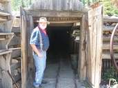
Among these is the Washington Mine, located on Boreas Pass in the southwestern outskirts of Breckenridge. Meticulously preserved and carefully reconstructed by the Breckenridge Heritage Alliance, the mine is nearly a three-dimensional diorama of the town’s mining history.

What remains of the mine today was once just the small antechamber of a much bigger operation that extended up from the current site.

But local historians have salvaged and, in some cases, rebuilt a small, cute campus that nevertheless paints a pretty realistic picture.

The 90-minute to two-hour tours of the Washington Mine run twice daily most days of the week.

A great option for families with children — the tour is entertaining, dimensional and, at times, hands on — local historians lead their guests back through the pages of Breckenridge’s history, showing and telling the way people lived in and out of the mines more than 100 years ago.

Kids will have an opportunity to explore an underground mine, peer down a mine shaft, meet a tommyknocker, detonate simulation dynamite and pan for gold, exploring the local history with at least four of the five senses.

For grown-ups, there’s the tour itself, offering an insightful look into the happenstance and economics that built Breckenridge. Tour guides also cover some of the more popular local legends, with exacting historical accuracy, of course, including that of the discovery of “Tom’s Baby,” a 13-pound gold nugget.

Complete with an (interpretive) underground mine tunnel, rails for transporting gold, a prospectors cabin and all the mechanics once used to empty the earth of riches, the Washington Mine has been beautifully preserved and reconstructed by the heritage alliance and is well stocked with relics of the mining age.

Located just a few minutes outside of Breckenridge, it makes for a fun and convenient family activity that is a little more unique and interactive than the average in-town museum.


Posted by on July 15, 2012 in Activities for the Family, Breckenridge Area, Silverthorne Area, Summer Activities!

Comments Off on Mine Tours in the Area

New Summer activities


Our Guests can use this link for activities in Silverthorne!


http://silverthorne.org/.aspx?page=17


Posted by on July 2, 2012 in Activities for the Family, Adventure Activities!, Lodge News, Silverthorne Area

Comments Off on New Summer activities

New Adventure Near our Lodges Zip Line!

This is a ball!

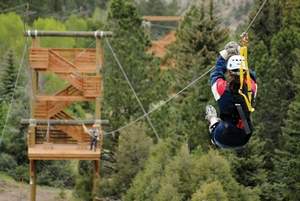
Stand up, lean forward and jump off the five-story tower.Don’t worry, though — you’re clipped into a cable designed to withstand a 4,500-pound tug.Still, there’s something unnatural about being so high and leaping into the unknown, even with mechanical devices ready to catch your fall and send you careening at speeds of 35-40 mph through Colorado Adventure Center’s new zipline in Idaho Springs.The adventure center and the new zipline are the product of a recent merger between longtime Summit County companies Highside Adventure Tours and Goodtimes Rafting and Glenwood Springs companies Rock Gardens Rafting and Glenwood Canyon Zipline.

Now, it’s four companies under one roof, able to service all of Interstate 70 between Idaho Springs and Glenwood Springs. Which means they can pull customers from Fort Collins to Colorado Springs in the east, capture some of the Vail market and draw from Western Slope cities.

“There are a lot of synergies between our companies,” said John Cantamessa, one of the four owners. “We are all good friends and we have proven we can do business together.”

Cantamessa originally bought Goodtimes Rafting from Kevin and Kathy Schneider. They became better friends during the transaction, and joked about joining their companies again. This winter, it became reality between the three along with the fourth owner, Jeff Hale.

Each of the four bring skills to the table, Cantamessa said. The Schneiders have marketing expertise, Cantamessa has extensive river know-how and Hale comes with a state parks perspective as well as experience as a charter captain and mountaineer.

“When you bring four people together with great skills, you’re going to get a great product,” Cantamessa said.

They raft Clear Creek, the Blue, the Arkansas, Upper and Lower Colorado stretches and the Roaring Fork. The also run bike shuttles, fishing tours and horseback riding.

And now, the company offers two ziplines — one in Glenwood Springs and one that opened this weekend in Idaho Springs.

Having all the offerings is ideal, Cantamessa said. He wanted to get into the Vail and Glenwood Springs market, but found it tough to snag without a Roaring Fork permit and Shoshone permit on the Colorado River. Rock Gardens found it tough to snag the Summit County and Front Range markets without the Upper Colorado, Blue and Arkansas river permits.

At about the time the merger went through this winter, Cantamessa and Kevin Schneider toured the new, riverside property that will become the adventure center’s Idaho Springs home. They finalized the purchase of approximately 10 acres of land and in March, began building the five towers that make up 3,000 feet of zipline. It was completed by firm Challenge Design Innovations, which does everything from recreational canopy tours to military tactical training facilities.


A good year to add activities

It’s a good year for a zipline to be added into the mix, Cantamessa said.

“We’re happy, because with the lack of water in some drainages, people still want to have fun. Zipping is the next best thing to rafting and biking,” he said, adding that it’s an ideal activity to create combo packages for those wanting to limit rafting to a half-day, but still fill the day with other activities. To do just the zipping, it costs $80 for five rides.

“Highside has always seen a strong correlation between people who raft and bike,” Cantamessa said, which was the impetus for creating the eastern zone zipline.

It’s said to be the longest tower-to-tower system in Colorado, with longer ones being canyon systems. One zip stretches a quarter-mile, and runs over Clear Creek. Zippers can wave to I-70 traffic as cars pass, or lean back and enjoy the view of the river.

The company is proud of its new location, and it’s already paying off with walk-in customers who stop by after seeing the system and signs from the highway. Owner and workers are busy working out a few operational kinks as well as completing the landscaping of the project’s initial phase. Future plans include building an aerial adventure park akin to the Glenwood Springs’ facility, and down the road bringing the boathouse upstream.

Cantamessa hopes he’s in front of the curve with the Idaho Springs zipline. He expects ski areas to build ziplines in the near future as part of the new summer recreation opportunities with the U.S. Forest Service. Some resorts have had short ziplines in the past, and Copper Mountain has had plans on the books for a 300-foot, multi-seasonal zipline at The Village at Copper.

New Adventure Near our Lodges Zip Line!

http://www.cheaptravel1.com/


Posted by on May 28, 2012 in Activities for the Family, Adventure Activities!, Lodge News, Silverthorne Area, Summer Activities!

Comments Off on New Adventure Near our Lodges Zip Line!

Golfing around Our Lodges

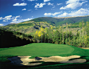
Summit County Golf


Posted by on April 14, 2012 in Activities for the Family, Silverthorne Area, Summer Activities!

Comments Off on Golfing around Our Lodges

Summer activities are the Lodge

CalendarCalendar of Events
These are just some of the events going on – check the town websites for even more to do while you are here!

Frisco Events

4 July – Frisco’s Fabulous Fourth of July Celebration

4 July – Independence Day 10K Trail Run

6 July – Frisco’s Founder’s Day Celebration

11 July – Concert in the Park Series: Dave Alvin & the Guilty Ones

13 July – Triple Bypass Bicycle Ride (Day #1)

18 July – Concert in the Park Series:  Fierce Bad Rabbit

19 July – Full Moon Fling Disc Golf

25 July – Junior Sailing Olympics

25 July – Concert in the Park Series: The Trishas


3, 4, 6, 10, 13,17, 19, 20, 21, 24, 27, and 31 July – National Repertory Orchestra Concerts

6, 7, 13, 14, 20, 21, 27, and 28 July – PRCA Pro Rodeo

5-7 July – July Art Festival

5 July – Blue River Series: The Wailers

11 July – Blue River Series: The Fabulous Thunderbirds

13 July – Breckenridge Festival of Film Tennis Tournament

26-28 July – Main Street Art Festival

26 July – John Adams Band Presents John Denver – The Tribute


Silverthorne Events


18 July – Ice Cream Social at Willow Grove Open Space

28 July – Rocky Mountain Triathlon

 Keystone Events  


4 July – 4th of July Celebration

6 July – Keystone Citizens League Open Meeting

6-7 July – Big Mountain Enduro

13-14 July – Keystone Wine and Jazz Festival

20 July – Boats N’ Brews

27-28 July – Rocky Mountain Revival Wellness Weekend


Copper Events

4-7 July – Wanderlust Colorado Festival

19 July – Freee Live Music – Rob Drabkin

20-22 July – Courage Classic

27 July – Hike MS Colorado & Benefit Concert

27 – Free Live Music – Bob Skizzum


Dillon Events

4 July – NRO Performance
4 July – July 4th Old Town Celebration
4 July – Amphitheater Concert
5, 12, 19, and 26 – Dillon Farmer’s Market (Friday’s throughout the summer)
6, 13, 20, and 27 – Sunset at The Summit Concert Series (Saturday’s throughout the summer)
19-21 July – Dillon Arts Festival

Summit County Summer Activities

Summit County Guide


Activities – Entertainment


Posted by on April 13, 2012 in Activities for the Family, Lodge News, Silverthorne Area, Special Deals, Summer Activities!

Comments Off on Summer activities are the Lodge

Trail expansion!

More trails to OPEN!!!

A seven-year work in progress, the Golden Horseshoe Management Plan will soon move from the draft stage into the long-awaited final approval and implementation stage.The plan for how trails in the open space area near Breckenridge will be used, maintained and developed is a joint effort between the three management agencies: Town of Breckenridge, Summit County and the U.S. Forest Service. Though it covers recreation, the plan also includes guidelines for handling natural resources and cultural resources. The 8,900 acre area lies between French Gulch on the south, Colorado Highway 9 on the west, and the Swan River drainage on the north. It lies north and east of the core of the Town of Breckenridge.

Breckenridge Town Council approved the draft plan Tuesday. It now awaits the OK from the Summit Board of County Commissioners, which should take place in early March.

Breckenridge Open Space and Trails director Scott Reid said changes could still be made to the plan, but based on feedback from the county commissioners at their Tuesday meeting, he doesn’t anticipate anything substantive.

“There are no surprises in here as far as we’re concerned,” Reid said, adding that the appendices of the document show the “exhaustive public input” that came in through the years.

It didn’t go without contest, though.

“It was a contentious process,” Summit County Open Space and Trails director Brian Lorch said, though he added, “We have not heard opposition (or questions) in a couple years.”

The major hang-up in getting the Golden Horseshoe Management Plan finalized was waiting for the Forest Service to finalize its Travel Management Plan, which will go into effect in May. The agency manages the most miles in the area, Reid said.

“This plan nests within that plan,” he said.

With the plan nearly finalized, officials are looking toward their next step: implementation.

The Forest Service’s goal is to get signs in place to mark trails that are open and closed according to the plan, Forest Service recreation staff officer Ken Waugh said.

“People should look for travel management signs,” Waugh said, adding that down the road when trail decommissioning takes place, they should respect revegetation areas. Motorized users can educate themselves with a Motor Vehicle Use Map, which will be released in May. Single-sheet guides are also available through the Forest Service’s Dillon Ranger District Office in Silverthorne.

Reid said that, though he doesn’t anticipate push-back as the document moves forward, he expects a reaction when implementation occurs.

“The old policy was: If it’s unsigned, you’re allowed on it. The new policy is: You’re not allowed on it unless it’s signed,” Reid said. “You must remain on designated routes. If you’re on an non-designated route, you’re automatically at issue.”

The rule applies to wheeled vehicles from bicycles to off-highway vehicles. Hikers and horses are exempt and can travel at will through the area, Reid said.

Reid added that though some users might be disappointed at the restrictions, they’ll be excited to see improvements to trails that can happen now that the travel management plan is nearly complete.

More info

The Golden Horseshoe Management Plan is available on the Town of Breckenridge’s website.


There’s an open house slated for 4:30-7:30 p.m. Thursday, Feb. 10, to exhibit preliminary designs for a new segment of the town’s Blue River recreation pathway from Town Hall to the Willow Grove Open Space.

Construction of the 2,100-foot segment is planned for summer 2011 and will be partially funded by a $500,000 grant from Great Outdoors Colorado. The segment is meant to connect two segments of trail that are currently connected by residential roads, improving aesthetics and safety.


We can help you with your fishing

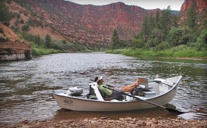
Did I ever mention that we have private Gold Metal waters on our Property. As our gust you can fish it exclusively! We also have Guild friends across the street at Cutthroat Anglers that we will personally hook you up with! My favorite is Sean Dailey, if he can  not fine you fish NO ONE WILL!  Let us make your dreams come true! We know where the trout are even if I can’t caught them!;)


Posted by on September 5, 2010 in Activities for the Family, Fishing around Our Lodges!, Silverthorne Area, Wildlife Around the Lodges

Comments Off on We can help you with your fishing

Fishing 15 minutes from our Lodges!

Our Local Chief of Police caught a Monster trout Just 15 minutes North of our Lodge! Green Mountain Resivour is the home for LARGE  lake trout!


Posted by on August 22, 2010 in Colorado Facts, Fishing around Our Lodges!, Silverthorne Area, Wildlife Around the Lodges

Comments Off on Fishing 15 minutes from our Lodges!

Silverthorne Colorado Improvements right next to Riverside Lodge!!

Wildernest Bridge Work Complete

The Town of Silverthorne is pleased with the end result of the Wildernest Road Bridge Resurfacing Project, including the construction timing and the public’s cooperation with the related detour plan.

The project took approximately 11 calendar days to complete which allowed for the bridge to be open to traffic by the beginning of the Memorial Day Holiday weekend.Though the detour may have taken some time to get used to and may have caused slight inconveniences, it was necessary in order to make these bridge repairs while also ensuring the safest possible work and driving environments.The Town of Silverthorne thanks motorists for their cooperation during this process.


Additional Sand Volleyball Courts Coming to Rainbow Park

The Town of Silverthorne is installing two new sand volleyball courts at Rainbow Park this summer.The courts are scheduled to be completed and ready for play by August. The new courts are adjacent to the two existing sand courts located next to the tennis courts.The project is possible thanks to generous donations from private sector businesses.Tom Davenport, with Denver based Volleyball of the Rockies, contacted the Town last month and offered to donate 400 tons of sand, nets, and boundary lines for two new courts.To complete the project, the Town needed to supply gravel for the subsurface, which was not in the Town’s budget.However, Silverthorne based Everist Materials graciously offered to donate 200 tons of washed rock for the project, after Public Works Director Bill Linfield asked the company for assistance.“The donation is a generous gift, and we are very grateful. The Town has worked with Everist on many projects over the years and we are very appreciative of the support. donation allowed us to proceed with a project that will benefit the entire community for years to come,” stated Linfield.

New Rainbow Park Playground Nears Completion

The opening day for the playground is almost here!  If the weather cooperates allowing final construction items to be addressed in the next few days, the playground will open on Saturday July 10.  The equipment is all in place now, but the poured in place rubber surface is not yet completed so we have to ask the kids to wait just a bit longer before they can climb on all of the great new structures we’ve installed.

A formal ribbon cutting ceremony is also being planned and will also be announced at Silverthorne.org when details are available.

Where are the public fishing locations on the Blue River?

We often get this question, particularly from our many visitors, so to clear up the issue the Town has created a brochure that highlights seven distinct sections of the Blue River as it makes its three mile run through Silverthorne.The map, available soon at the Recreation Center and Town Hall, provides a clear picture of public access and public parking available near the river.descriptions of the types of water features in each section are also included in the brochure.The Town of Silverthorne is committed to protecting, preserving, and improving the gold medal water of the Blue River and has spent over $700,000 (largely obtained through grants) to improve the health of the river.

The Town would like to thank SPORT Committee members Don Hansen and Nathan Mosley for creating the fishing map with the assistance of Public Works Administrative Assistant Diane Salamon.

Outlets at Silverthorne Welcomes Guess

GUESS Factory Store at the Outlets at Silverthorne opened its doors in mid-June and held a grand opening/ribbon cutting ceremony on Monday, June 28.   Now a global presence, GUESS got its start with a great pair of jeans.In 1981, The Marciano brothers founded a small denim company in California.Today, GUESS has grown to be one of the largest and most successful fashion brands in the world with over 1,113 GUESS stores worldwide.Through their innovative design, marketing and distribution of fashion lifestyle products, GUESS has become one of the most widely recognized fashion leaders in the young contemporary women’s and men’s markets across the globe.The GUESS Factory Store at the Outlets at Silverthorne will carry men’s and women’s fashion-forward apparel, handbags, watches, shoes and more! The store is located  in Unit 227-I in the Blue Village, between Great Outdoor Clothing Company and Pearl Izumi.


Posted by on July 9, 2010 in Colorado Facts, Silverthorne Area

Comments Off on Silverthorne Colorado Improvements right next to Riverside Lodge!!

Dillon Marina and Yacht club…The Highest in North America!

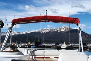
Our family  rents a boat here each summer. The experience is one of a kind. This is a highly recommended activity! Yes a the Tikki bar afterwards is the best!;))

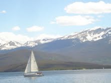
Lake Dillon is the largest lake in the area and offers magnificent mountain vistas, with easy access to the Town of Dillon, shopping, lodging, RV sites, and camping. The Dillon Marina hosts exciting weekend sailing regattas and other boating events for fun and sport. The marina offers a full service maintenance shop with slip rentals available for short or long term. Motorboats and sailboats are available for exploring the lake, fishing or basking in the summer sun. The lake is home to Brown trout and Rainbow trout. With 26 miles of shoreline, finding a nice secluded spot to cast is not a problem.

Discover summer fun for the entire family. The Dillon Marina is a full-service marina in Summit County that offers access to beautiful Lake Dillon and world class sailing in Colorado. Boating, trout fishing and mountain recreation opportunities abound. The marina offers boat rentals, sailing instruction, racing regattas and is home to the Dillon Yacht Club, the highest club in North America at over 9000 feet in elevation.

The recreational choices in the area are endless. Across from the marina is a trailhead to miles of paved bike paths offering spectacular scenic tours. The surrounding National Forest also provides mountain-biking, rafting, fishing, hiking, horseback riding and camping. Jeep tours on old mountain roads will take you to nearby historical mining towns. Be challenged at one of Summit County’s four championship golf courses. In Dillon, play a set of tennis, or simply take a stroll and have a picnic by the lake. The pace here is easy.


AVAILABILITY

Our rental boats are available starting at 9:00 AM and must be returned for the day by 5:30PM. Boats returned after a scheduled return time or after 5:30 will incur a late fee of $75.00 + any additional rental time used.

RESERVATION REQUEST FORM

PLEASE NOTE! A reservation is NOT final until a Dillon Marina crew member has contacted you for a visa or mastercard# to secure this reservation. If your request is for an immediate or same day boat rental, please call the marina directly at 970-468-5100.


RENTAL PERIODS

All boats are rented for either a 2-hour, 3-hour or 4-hour period, with 2 hours being the minimum rental period. An 8 hour or full day rental is two times the 4 hour rate.

FUEL

Boat rental rates do not include the cost of fuel. Fuel prices vary.

AGE RESTRICTIONS

Boat skippers must be at least 21 years old

BOAT CAPACITY

Maximum boat capacity for each boat type includes ALL persons aboard (including infants and children) and cannot be negotiated.

LIFE JACKETS

Life jackets are included in the cost of the rental. All children 13 and under are required to wear thier life jackets at all times.

RENTAL REQUIREMENTS

Rental customers are required to leave their drivers license and either a Master card or VISA card as security while on the water. Boats will NOT be rented without a credit card.

Colorado Law states: It is illegal to operate any boat under the influence of alcohol!

CANCELLATION POLICY

A reservation may be cancelled at any time prior to 48 hours before your scheduled rental, with no penalty. Reservations cancelled within 48 hours will incur a cancellation penalty of 20% of the rental fee which will be charged to your credit card.

FISHING

We DO NOT sell fishing licenses and stock very limited fishing supplies in our ship store. If you plan on fishing, it is a good idea to obtain these items prior to renting a boat.

RESERVOIR RESTRICTIONS

Swimming, jetskiing, waterskiing and tubing are not allowed on the reservoir.

The speed limit on the reservoir is 30 mph.

Runabout 18′

Dillon Marina’s 18′ Runabouts have a maximum capacity of 6 people. The boats have a 130hp inboard motor and a side-console steering wheel. All runabouts have an open bow & come with a bimini for optional sun and weather protection.

  • 2-hours: $105.00
  • 3-hours: $140.00
  • 4-hours: $170.00


Posted by on July 5, 2010 in Activities for the Family, Dillon Area, Silverthorne Area

Comments Off on Dillon Marina and Yacht club…The Highest in North America!

Summit County Summer activities! 2010

One thing is for sure there is always something do here in the mountains! Some of my “Do not Miss List Items” are the Dillon Amphitheater concerts…usually FREE and great family fun. Yes and then of course a the weekend festivals at the big resorts-Keystone Copper and Breckenridge.

Summit County Calendar of Events

What’s Happening in Breckenridge, Keystone, Copper Mountain, Frisco, Dillon, and Silverthorne

June-Aug :: Summer Music in Breckenridge :: More than 40 classical and non-classical concerts and ensemble performances. Riverwalk Center. Box Office: 970-547-3100

June 3, 10, 17, 24 :: 6pm :: Country Dancing, first half hour of instruction
will feature the basics followed by open dancing until 8pm, Dillon Amphitheatre


June 5 :: Marina Season Opener, Frisco Bay Marina

June 5 :: Kids Fishing Derby, free fishing derby for children 14 and under, Trent Park, Silverthorne

June 10-13 :: Breckenridge Festival of Film, 970-453-6200, www.breckfilmfest.com

June 11, 18, 25 :: 9am-2pm : Farmers’ Market, live entertainment 10:30am-1pm, Buffalo Street, Downtown Dillon

June 12 :: 8am :: 34th Annual Run the Rockies, Registration at Frisco Recreation Building

June 14, 15, 21, 22 :: 9:45-11am :: “Explore” Lake Dillon Boat Tours. Reservations required. Dillon Marina. 970-468-5100, dillonmarina.com

June 15, 22, 29 :: 11am :: Kid’s Discovery Days, Keystone Resort

June 17-19 :: Colorado Barbecue Challenge. Kick-off Concert, June 17, 8pm, Main Street Frisco

June 18-20 :: Lift-Off Summer, Copper’s opening weekend with activities, specials and live music,
Copper Mountain

June 19-20 :: Kingdom Days, Breckenridge’s annual heritage celebration, Corner of S. Ridge St.
and Washington Ave.

June 23, 30 :: 5pm :: Family Fun Nights, Keystone Resort

June 25-27 :: Genuine Jazz & Wine : Fri, 9pm; Sat, 1pm & 9pm; Sun, 9:30am; www.genuinejazz.com, The Village at Copper

June 25-27 :: 10am :: Merchant Tent Sale, Keystone Resort

June 25 :: 7pm :: Friday Night Concerts, Dillon Amphitheatre

June 26 :: 6th Annual World Music Fest, Keystone Resort

June 26 :: Annual Flea Market,Silverthorne Recreation Center Parking Lot

June 26 :: 10am :: Saturday Morning Adventures, Marina Park Pavilion by the Dillon Amphitheater

July 2 :: Noon-5pm :: Arts District Grand Celebration, Arts District of Breckenridge (corner of S. Ridge St. and Washington Ave.)


July 2-4 :: Frisco’s Fantastic Fourth of July, parade, kids fishing derby, live music, Green Art Festival, Founder’s Day celebrations, fireworks. Main Street Frisco and Frisco Bay Marina


July 2-4 :: 3 Ring Weekend, free family event featuring live music, conscious carnival, “Primp my Ride” kid-powered parade, fireworks, Copper Mountain, 3ringweekend.com

July 2, 9, 16, 23, 30 :: 9am-2pm :: Farmers’ Market, Buffalo Street, Downtown Dillon

July 2, 9, 16, 23, 30 :: 10 & 11:30am :: Rapunzel: A Rock-n-Roll Fairytale, Quaking Aspen
Amphitheater, Keystone Resort

July 2, 9, 16, 23, 30 :: 7pm :: Friday Night Concerts, Dillon Amphitheater

July 3, 10, 17, 24, 31 :: 7pm :: Sunset at the Summit Concerts, Dillon Amphitheater

July 3 :: 10am :: Frisco’s Founder’s Day, Frisco Historic Park

July 3, 17 :: 11am :: River Run Kidzfest, Keystone Resort

July 4 :: 11am :: Breckenridge Independence Day Celebration, 10K trail race, “Firecracker 50” bike race, Main Street parade, various activities and music throughout town. Main Street Breckenridge, www.gobreck.com

July 4 :: Noon :: 4th of July Celebration, National Repertory Orchestra in the morning followed by
music by DooWop Denny, children’s bike parade, BOCCE tournament, pie-eating contests and more. Downtown Dillon

July 4, 11, 18 :: 1pm :: Afternoon Concerts, Dillon Amphitheater

July 5-11 :: Breck Bike Week, 970-453-2913, www.gobreck.com

July 6, 13, 20, 27 :: 11am :: Kid’s Discovery Days, Keystone Resort

July 6, 13, 20, 27 :: 6-7pm :: Stories Alive Story Hour, Quaking Aspen Amphitheater, Keystone Resort

July 7, 14, 21, 28 :: Noon :: Historical Lecture Series, Gazebo, Frisco Historical Park

July 8, 15, 22, 29 :: 6pm :: East Coast Swing/Jitterbug, Dillon Amphitheater

July 9, 16, 23, 30 :: 6pm :: FAC – Fridays at Copper, free concerts and outdoor movies, Copper Mountain

July 10, 17, 24, 31 :: 10am :: Saturday Morning Adventures, Dillon Marina Park Pavilion

July 16-18 :: Parker Artists Guild Village Art Walk, www.parkerartistsguild.com for times, Village at Copper

July 16-18 :: Dillon Arts Festival, Downtown Dillon off of Lake Dillon Drive

July 17 :: 10am :: Historic Frisco Town Tour. Enjoy a free, guided tour of Frisco’s Heritage attractions. Frisco Historic Park & Museum.

July 18, 25 :: 11am :: Music in the Mountains Concert Series, Keystone’s River Run|

July 21 :: 6pm :: John Adams & Friends Summer in Colorado Concert, Dillon Amphitheater

July 24 :: 8-10pm :: Saturday Concert Series, Copper Mountain

July 24 :: 4pm :: River Run Rocks, Keystone’s River Run

July 24-25 :: 10am-2pm :: Frisco’s Classic Weekend, classic wooden boat show and marina parade, Frisco Marina

July 25 :: 9am:: ‘Vettes on the Rockies, more than 500 Corvettes on Main Street Frisco

July 29 :: 7pm :: Smokey Joe’s Café: The Music of Leiber and Stoller, River
Run at Keystone

July 30-Aug 1 :: Colorado Gold Panning Championships, Breckenridge, www.gobreck.com

July 30-Aug. 2 :: 21st annual Children’s Hospital Courage Classic, Copper Mountain, www.couragetours.com

July 31-Aug. 1 :: 11am :: Dillon Open Regatta, Dillon Marina

July 31-Aug. 1 :: 14th Annual Bluegrass and Beer Festival, Keystone Resort

Aug. 1, 8, 15, 22 :: 1pm :: Sunday Afternoon Concerts, Dillon Amphitheater

Aug. 1, 8, 15, 22, 29 :: 11am :: Music in the Mountains Concert Series, Keystone’s River Run

Aug. 3, 10, 17, 24, 31 :: 7-8:30pm :: Dancin’ in the Rockies Dance Series, free lessons in swing, line, salsa and tango. Final Tuesday in August will culminate into Summit County’s Biggest Dance Party, Pavilion at Keystone

Aug. 6, 13, 20, 27 :: 9am-2pm :: Farmers’ Market, Buffalo Street, Downtown Dillon

Aug. 6, 13, 20, 27 :: 7:30pm :: Friday Night Comedy Series, Pavilion at Keystone,
www.keystoneneighbourhood.com

Aug. 7, 14, 21, 28 :: 7pm :: Sunset at the Summit Concerts, Dillon Amphitheater

Aug. 4, 11, 18, 25 :: Noon :: Historical Lecture Series, The Gazebo, Frisco Historical Park

Aug. 5, 12, 15, 19, 26 :: Smokey Joe’s Café: The Music of Leiber and Stoller, Thurs.,
7pm; Sun., 2pm, River Run at Keystone

Aug. 6, 13, 20, 27 :: 6pm :: Fridays at Copper, Free concerts and outdoor movies, Copper Mountain

Aug. 6-7 :: 10am-10pm :: Dillon BBQ at the Summit, Town of Dillon, www.bbqatthesummit.com

Aug. 7 :: 5:45-8am start :: Copper Triangle Bicycle Tour, www.coppertriangle.com

Aug. 7 :: 9am :: Canine 4K, Dogs and their humans run or walk the 4K course, Frisco Main Street

Aug. 7-8 :: Art on Main Street to the Rockies, Fine art show, Frisco Main Street

Aug. 6-8 :: Mountain States Cup, largest full-discipline race series in the U.S., Keystone Resort

Aug. 12-13 :: Guitar Town Guitar & Songwriting Clinic, Copper Mountain, www.copperguitartown.com

Aug. 13-15 :: Guitar Town, the world’s best guitarists come together at Copper for the 5th annual festival, www.copperguitartown.com

Aug. 13 :: 5pm :: Dillon Bluegrass Festival, Dillon Amphitheatre

Aug. 14 :: 11am :: River Run Kidzfest, Keystone Resort

Aug. 14 :: 11am :: The Collision, skate park competitions, Frisco Skate Park

Aug. 14 :: 25th Annual Music on Main, free concert, Main Street Frisco

Aug. 21 :: 10am-3pm :: Frisco Free Family Fun Fest, Frisco PeninsulanRecreation Area

Aug. 21-22 :: Warrior Dash Rockies, Copper Mountain

Aug. 21-22 :: 6th Annual Blues Festival and Art Show, Keystone Resort

Aug. 22 :: 7am :: Blue River Century Ride, bike race to benefit the Lance Armstrong
Foundation, Keystone Resort

SEPTEMBER
Sept. 3, 10, 17, 24 :: 9am-2pm :: Farmers’ Market, Buffalo Street, Downtown Dillon

Sept. 3, 10, 17, 24 :: 7:30pm :: Adrenaline Movie Series, Pavilion at Keystone, www.pavilionatkeystone.com

Sept. 3 :: 6pm :: FAC – Fridays at Copper, Free concerts and outdoor movies

Sept. 3-5 :: Copper Country, Free Labor Day festival tradition, coppercountryfest.com

Sept. 3-5 :: Fri., Noon-6pm; Sat., 10am-6pm; Sun., 10am-2pm : Dillon Craft Fair, Downtown Dillon

Sept. 3-6 :: Breckenridge Labor Day Weekend Festivities, 970-453-2913, www.gobreck.com

Sept. 4 :: 7pm :: Sunset at the Summit Concerts, Saturdays, Dillon Amphitheater

Sept. 4 :: 22nd Annual Taste of Keystone, Keystone Resort

Sept. 5 :: 1pm :: John Adams & Friends Fan Appreciation Concert, Dillon Amphitheater

Sept. 6 :: 2pm :: Marina Mutt Contest, Registration starts at Noon, Dillon Marina

Sept. 10-12 :: Copper Criteriums, Cyclecross & Fall Colors Ride, www.coppercrits.com

Sept. 11 :: Beetlefest, Frisco Main Street

Sept. 17-19 :: 16th Annual Breckenridge Oktoberfest, 970-453-2913, www.gobreck.com

Sept. 17-19 :: The America Cup International Fly Fishing Tournament, Frisco, Blue River and other local rivers

Sept. 24-26 :: Camp Experience, Oneof- a-kind retreat exclusively for women, Copper Mountain. CampExperience.com

Sept. 25 :: Annual Flea Market, Recreation Center Parking Lot, Silverthorne

OCTOBER
Oct. 31 :: 6-8pm :: Trick or Treat Street on Main Street Frisco


Posted by on June 5, 2010 in Activities for the Family, Dillon Area, Frisco Area, Silverthorne Area, Ski Mountains!

Comments Off on Summit County Summer activities! 2010

Rafting In Summit County 2010

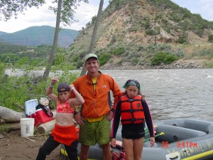
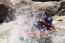
Ok friends, it looks like the 2010 rafting season will be another great year! The Blue River that runs right through our Riverside Lodges East and West is navigable! This means the surrounding rafting rivers are also going to be a blast! Do not miss out on this exhilarating activity! Remember to bring your sunscreen or you could end up like me, burned to a crisp! (I have done this m0re than once)

Sure, Colorado may be best known for its skiing, but the same snow-covered peaks that give us our world-class slopes also provide another unique recreational asset — rivers, as in rafting.

“Colorado is the Mecca,” veteran river guide Duke Bradford said regarding the quality of the area’s whitewater. “The fact we have these huge mountains with incredible grading, it’s remarkable. The water, coming down that grading, makes for amazing rivers.”

And the areas in and surrounding Summit County are great examples of that.

In close proximity, Bradford said, there’s a stretch of water for “anyone,” regardless of ability or fitness level.

“Right in our own backyard, we have some unique circumstances,” said Bradford, who’s the director of Breckenridge-based Arkansas Valley Adventures. “The Continental Divide provides both the Eastern and Western slopes with great whitewater, and we have access to it all.”

The Blue, Arkansas and Colorado rivers, along with Clear Creek, all provide world-class rafting, and Bradford said the seasons for each look very promising.

The same couldn’t have been said just a few months ago.

Along with the rest of the state’s whitewater enthusiasts, Bradford was a bit concerned about what the summer would hold — or rather, if the rivers would be holding much at all.

The snowpack was low, and the outlook for whitewater was even lower around March. But a late cold snap in April and May vaulted the moisture levels back near average numbers, and, as Bradford put it, “more snow means more whitewater.”

“The water’s looking great,” Bradford said. “It’s up, but not to the point you have to be worried about it being dangerous in stretches.”

A true sign of the season, Bradford said, is that there’s a season at all on the Blue River. Some years, the river’s flows (below the Dillon Reservoir) are far too low to raft at all.

That’s not a problem this year.

Bradford said the Blue is currently running well. And, as the river may hit its peak in the coming weeks — possibly even days — now’s the time to go down it.

“It’s anyone’s guess how long it’ll last, but we should have at least a couple weeks,” he added about the Blue.

The Arkansas, however, is looking to have a long season, possibly past the end of August, due to high amounts of winter precipitation on Hoosier Pass. Bradford said the “Ark” is commonly consistent for boaters, as it has controlled releases from the reservoir.

Clear Creek, in the stretches near Idaho Springs, is already running well and should continue to do so until early August.

“That’s the closest, most consistent whitewater we have,” Bradford said.

And in each of the rivers, Bradford said a boater of every ability can find the stretch that’s right for them.

For instance, the Colorado River has arguably the best stretch of class IV and V rapids anywhere in the country in Gore Canyon near Kremmling. There’s a waterfall, long runs, and Bradford said the stretch is strictly for the “active and aggressive” boaters with a whole lot of experience. (Swimming tests — including recovery from under the raft — are required to paddle down the area.)

On the other hand, the Colorado also offers some pretty leisurely paced float trips.

“It’s all about finding the section that’s right for you,” Bradford said. “There are so many options, you just don’t want to be over your head.”

Bradford said any of the county’s many outfitters would easily steer a boater in the right direction.

After all, finding the right run, Bradford said, can lead to one of the best experiences Colorado offers.

“Being out on the river — It’s just a big, majestic place,” he said. “The environment a river takes you to is off the beaten path, it’s not something you see doing anything else. To experience something like that is certainly unique to Colorado.”


Posted by on June 5, 2010 in Activities for the Family, Colorado Facts, Lodge News, Silverthorne Area

Comments Off on Rafting In Summit County 2010

What Determines The Flow Of the Blue River That Runs Though Our Property?

It is important to understand how the water flow in the Blue River is determined. This effects our fishing and rafting in it! The simple guide line is in the Spring and early Summer the flow is generally higher and in Fall and Winter it is less. But when in doubt just check with the Forest Service office about 1 mile North on Hwy 9! Remember, as shown above the Source for the River is a Dam, that is why the River produces HUGE trout and large swings in CFS water flow amounts!

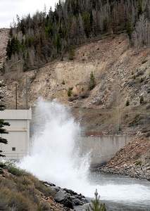
Water from Dillon Reservoir began flowing through the morning glory spillway into the Lower Blue River at 5 a.m. Tuesday. Water spills through the “glory hole” when the reservoir’s water level reaches its full elevation of 9,017 feet.

Water also flows through the waterworks and into the Blue River from the bottom of the dam. The spillway ensures water never flows over the top of the dam.

Outflows into the Lower Blue reached 235 cubic feet per second (cfs) Tuesday, with 220 of that coming from the bottom of the dam. As the snowpack continues to melt, the percentage of water coming from the top of the reservoir, via the spillway, will increase.

Outflows into the Lower Blue are forecast to peak at 1,100 cfs on June 9. Inflows are forecast to peak at 1,300 cfs on June 9.

Actual peak flows will vary from the forecasts depending on weather: Warm, sunny weather would produce higher peak flows over a relatively short period of time; cooler, cloudier weather — resulting in slower snowmelt — would translate to a lower-

volume peak spread over a longer period of time.

The Lower Blue is generally fine for rafting at flows higher than 500 cfs. To reduce the likelihood of flooding along the Lower Blue, Denver Water tries to ensure that peak outflow doesn’t exceed 1,800 cfs.

“There is always some risk of flooding downstream,” said Denver Water’s manager of raw water supply, Bob Steger. “The reservoir could be spilling, and we could get a bunch of rain. That’s a risk we have every year while we’re spilling.”

The historic average peak inflow is about 1,700 cfs, and Steger said this year’s flows would not likely reach that level. Average peak outflow is about 1,100 cfs and occurs around June 20.

“People in Silverthorne still need to be kind of diligent in understanding that anything can happen as far as weather is concerned,” Steger said.


Posted by on June 2, 2010 in Activities for the Family, Colorado Facts, Fishing around Our Lodges!, Silverthorne Area

Comments Off on What Determines The Flow Of the Blue River That Runs Though Our Property?

Silverthorne information!

Of course you know we are partial to this town in that our Lodges are located here and the people are especially nice!

Silverthorne Colorado


The Town of Silverthorne incorporated in the 1960’s and has flourished with the tourism brought on by the ski industry ever since. With the Blue River and its world-class fly fishing and proximity to the Ptarmigan and Eagles Nest Wilderness areas, Silverthorne is an outdoor enthusiast’s dream destination. Summer or winter, Silverthorne offers numerous Summit County activities and state-of-the-art facilities such as its newly completed Recreation Center for indoor adventures in fitness. The Dillon/Silverthorne Factory Outlet Stores provide over 70 brand name shops which are widely known for quality, value and variety and help make Silverthorne a popular stop for all visitors to the area.


Driving Directions

From Denver, Colorado:


  • Take I-70 WEST exit towards GRAND JUNCTION / IDAHO SPRINGS and drive for 55 miles.
  • Take the CO-9 NORTH / SILVERTHORNE(US-6 E) exit towards SILVERTHORNE, exit #205 and you are in Silverthorne, Colorado.

Silverthorne Recreation Center

Silverthorne Silverthorne Recreation CenterEncompassing 62,000 square feet, the recreation center features quality facilities, recreational programming and activities for all ages. The center offers yoga, land and water aerobics, personal training, indoor cycling, fitness equipment, racquetball courts, babysitting and massages therapy. Whether in for a full workout or a soak in the Jacuzzi after a day on the slopes, the Silverthorne Recreation Center has something for everyone.

Hours of Operation:
Monday – Friday 6:00am – 9:00pm
Saturday – 7:00am – 9:00pm
Sunday – 8:00am – 9:00pm


For more information call 970-262-7370

Silverthorne Pavilion


Silverthorne Silverthorne PavilionWhat a better place to have your big wedding day than at an elegant pavilion bordering the Blue River in Silverthorne. With magnificent balconies, arched ceilings, French doors, spectacular chandeliers, abundance of natural light and cozy furnishings you can have the perfect setting for a mountain wedding. Not to forget about the large dance floor and elevated area for a live band or DJ. To view this attractive venue call 970-262-7390.
Location:
400 Blue River Highway
Silverthorne, Colorado 80498

Phone Number:
970-262-7390


Posted by on May 17, 2010 in Activities for the Family, Colorado Facts, Lodge News, Lodge Orientation, Silverthorne Area

Comments Off on Silverthorne information!

Georgetown Loop Railroad_Great Family fun!

Devil's Gate High Bridge

We have had many guests and family members do this and I have not had 1 bad review yet! The views are one of a kind. As usual I recommend the earlier in the day the better before the afternoon storms build! Enjoy.


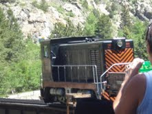
Georgetown Loop Railroad


The History of the railroad dates back to the time when the mountains were not only majestic, but the treasures they held within were extremely valuable. The silver ore found inside the mountains between Georgetown and Silver Plume in the 1860’s turned out one of the great silver-producing regions in the world.

By 1877, a rail line connected Denver to Golden and Georgetown was completed. The engineers did not stop there, but were presented with a challenge of connecting Georgetown to Silver Plume to climb more than 600 feet in just 2 miles while climbing one of Colorado’s steep canyons.

It took 200 men to lay 4 miles of track, building one of the world’s most famous engineering masterpieces, The Devil’s Gate High Bridge. Over a 100 years later, a ride on the Georgetown Loop Railroad brings you back in time. The beauty seen on the ride is spectacular and the experience will last a lifetime.

The adventure can be started at 1106 Rose Street at the Old Georgetown Station. You may also explore the history and miner’s livelihood with a tour of the Lebanon Silver Mine. The mine tour is accessible only by train. The Georgetown Loop Railroad invites you and your family to ride the railroad this summer. For railroad tours, the reservation phone number is 1-888-4-LOOP-RR (1-888-456-6777).


Posted by on May 17, 2010 in Activities for the Family, Colorado Facts, Silverthorne Area

Comments Off on Georgetown Loop Railroad_Great Family fun!